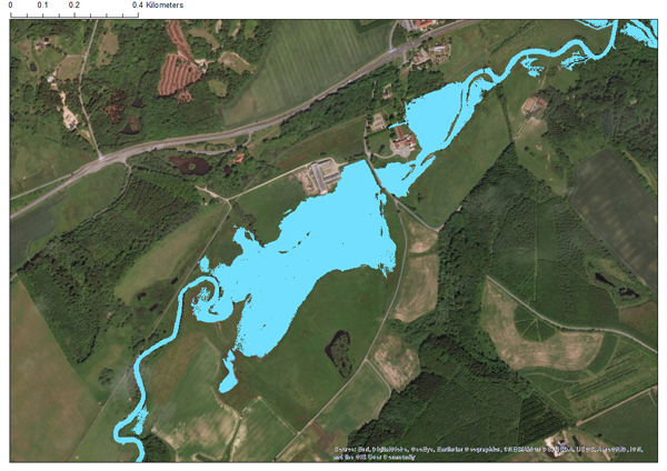
 Flood map of a stretch of Vejle Å, Denmark. Mapped using a simple data-driven machine learning method combined with a topography GIS layer.
The Danish Environmental Protection Agency (DEPA) seeks to use and combine existing hydrological and meteorological data in new innovative ways. Because of this, the DEPA initiated a pilot project with the aim of exploring new possibilities and technologies. The project offers a water forecast system providing forecasts of water levels and flood risks.
The pilot project used Vejle stream as an example. Here, DHI developed a simple and reliable data-driven method for flood mapping. The method is based on stream water level, which is forecasted by utilising an artificial neural network algorithm. With this efficient machine learning method, the stream level was predicted for the coming 24 hours with the help of only precipitation data. The DHI pilot study succeeded by meeting a DEPA target of a maximum 15 cm error-rate in the predicted water levels for 96% of the time during a two-year simulation period.
‘Stream water level forecasting is without a doubt an important task in flood management. By leveraging on the benefits that machine learning provides, decision makers are able to quickly forecast river water level with high accuracy. This ultimately supports better decision making in flood management’, says Nicola Balbarini, Water Resources Expert at DHI.
For more information, contact:
Oluf Zeilund Jessen
Head of Department
Water Resources Department
ozj@dhigroup.com
Anders Chr. Erichsen
Sales Manager
aer@dhigroup.com
Nicola Balbarini
Water Resources Expert
niba@dhigroup.com