Unmanned Aerial Vehicles (UAVs), commonly known as drones, offer exciting new perspectives for monitoring and measuring in rivers and streams. DHI is part of the RIVERSCAPES consortium that will develop, demonstrate and assess a new UAV monitoring solution that delivers innovative hydrometric and ecological data at high spatial resolution and coverage.
The consortium is made up of DTU Environment, DTU Space, Drone Systems, The Capital Region of Denmark, Vejle Municipality, The Region of Southern Denmark, Orbicon and DHI.
A powerful combination of data and tools for water management
Operational data are essential for monitoring and managing water. Combining these data with modelling tools like MIKE Powered by DHI software is the basis of planning decisions and operational services.
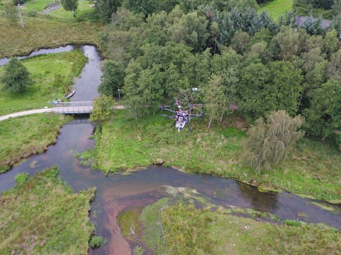
A drone’s-eye view. © Filippo Bandini (used with permission)
The aim of the RIVERSCAPES project is to develop a new monitoring solution using the latest advances in UAV and sensor technology. In doing so, we will help support the management of water, land, aquatic ecosystems and biodiversity, as well as inform planning and investment decisions to handle hydrological extremes and climate adaptation.
The project will develop a novel payload delivering the following high-resolution datasets:
- Water level in rivers, lakes and floodplains
- Bathymetry (terrain elevation of dry and submerged river bed and surroundings)
- Water surface velocity (full 2D velocity field at the water surface)
- Thermal maps of water and land surfaces for mapping of exchange and mixing processes
- Narrow-band spectral reflectance of water and land surfaces for vegetation/habitat mapping
- High-resolution digital surface models of the stream environment
‘The application of drone technology is an exciting new area of commercial growth. With RIVERSCAPES we are taking the next step, moving beyond just capturing amazing images to quantitative measurements of hydrometric and ecological data needed to solve modern challenges in water engineering. Mounting sensors on a UAV platform delivers unprecedented flexibility and spatial resolution.’
- Dr Michael Butts, R&D program manager at DHI
The RIVERSCAPES project and our contribution will play a major role in driving forward the application of UAV technology in water management and services.
Acknowledgement
RIVERSCAPES is supported by Innovation Fund Denmark under the Grand Solutions theme